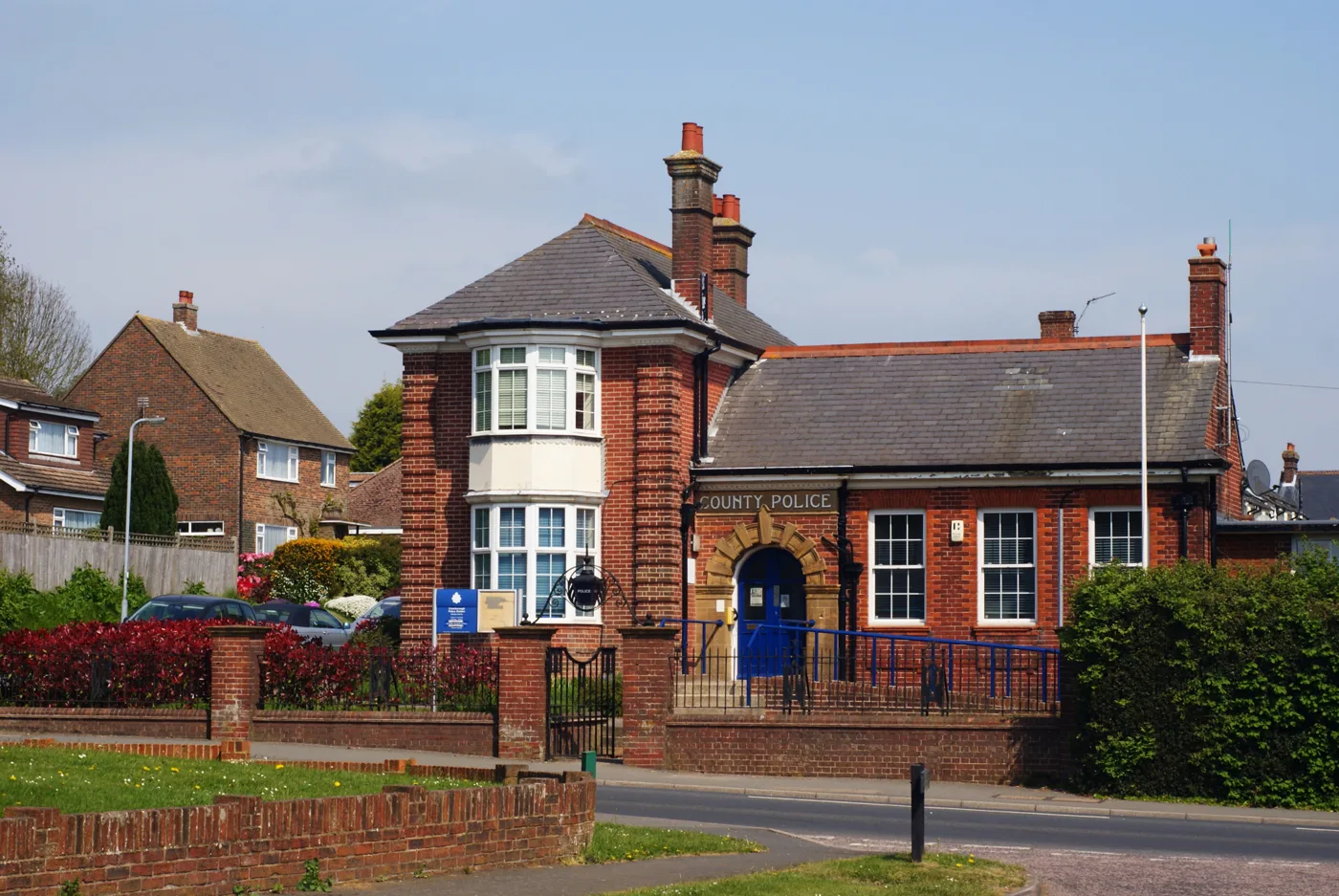

Crowborough had 115 crime and anti-social behaviour reports in August, the most in two years. The 12-month total rose 12%; Uckfield's barely moved.
Police recorded 115 crimes and anti-social behaviour reports in Crowborough in August 2026. That is the highest monthly figure in the two years we checked. August 2025 had 88.
One month can mislead, so we also compared whole years. In the 12 months to August 2026 there were 1,038 reports, against 923 in the 12 months before. That is a rise of 12 per cent.
Uckfield, about seven miles south, was flat when measured the same way: 919 reports against 909, up 1 per cent.
The figures come from police.uk, which publishes every crime and anti-social behaviour report Sussex Police records. We downloaded 24 months of them on 7 October. We counted the force’s own five Crowborough neighbourhood areas: Crowborough West, North, East, Jarvis Brook and St Johns.
What rose and what fell
| Type | Sep 2024 to Aug 2025 | Sep 2025 to Aug 2026 | Change |
|---|---|---|---|
| Violence and sexual offences | 349 | 405 | up 16% |
| Anti-social behaviour | 167 | 209 | up 25% |
| Public order | 57 | 97 | up 70% |
| Criminal damage and arson | 80 | 94 | up 18% |
| Other theft | 56 | 59 | up 5% |
| Shoplifting | 85 | 49 | down 42% |
| Vehicle crime | 48 | 34 | down 29% |
| Burglary | 25 | 27 | up 8% |
| Drugs | 12 | 27 | more than doubled |
| Other crime | 29 | 14 | down 52% |
| Possession of weapons | 8 | 11 | up 3 |
| Robbery, theft from the person and bicycle theft | 7 | 12 | up 5 |
| Total | 923 | 1,038 | up 12% |
| Total, excluding anti-social behaviour | 756 | 829 | up 10% |
The rises are concentrated in three categories:
- Violence and sexual offences, up 56 reports to 405. This is the biggest category, and police.uk does not split it further. It runs from harassment and common assault to serious injury.
- Anti-social behaviour, up 42 reports to 209.
- Public order offences, up from 57 to 97.
Drugs offences more than doubled, from 12 to 27. Drugs figures mostly reflect police activity, because they are usually recorded when officers find something, not when someone reports it.
Two kinds of crime that hit households and shops fell sharply. Shoplifting dropped from 85 reports to 49, and vehicle crime from 48 to 34.
Month by month
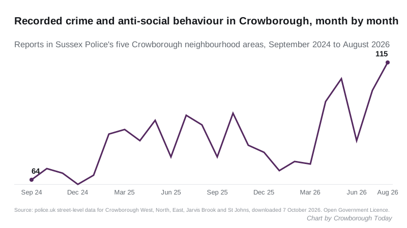
The town ran at 62 to 69 reports a month in late 2024, starting from 64 in September. Through 2025 it was mostly between 70 and 90.
Four of the five busiest months in the two years came this year. April had 98, May 108, July 103 and August 115.
August’s 115 broke down as:
- 43 violence and sexual offences, against 35 in August 2025
- 35 anti-social behaviour reports, against 27
- 9 public order offences and 9 criminal damage reports
- 19 other crimes, including 6 shoplifting reports and 3 bicycle thefts
Of August’s 80 crimes, leaving out anti-social behaviour, police.uk lists 32 as still under investigation. It lists 28 as closed with no suspect identified, and 16 where the suspect could not be prosecuted.
Where in town
| Area | Sep 2024 to Aug 2025 | Sep 2025 to Aug 2026 |
|---|---|---|
| Crowborough North (includes the town centre) | 357 | 355 |
| Crowborough East | 221 | 244 |
| Crowborough West | 166 | 236 |
| Crowborough Jarvis Brook | 138 | 160 |
| Crowborough St Johns | 41 | 43 |
The town centre area did not change. Crowborough West, which takes in Pine Grove, Beacon Road and the southern stretch of Uckfield Road, accounts for most of the rise: up 70 reports, or 42 per cent.
Police.uk does not publish addresses. It moves every report to the nearest of a set of anonymous map points. One of those points, on Uckfield Road on the southern side of town, had 59 reports in the last 12 months, against 3 in the year before. The reports there started in December 2025, with 7 that month.
Of those 59, 27 were violence and sexual offences, 9 criminal damage, 8 public order, 7 anti-social behaviour, 4 drugs and 4 other theft.
Police.uk says nothing about who was involved, as victim or suspect, or what is at a map point. These figures cannot tell you what lies behind that cluster, and we have not guessed. Without that one point, the town’s 12-month total rose by 6 per cent, from 920 to 979.
What the council said about crime
The Crowborough Army Camp began housing asylum seekers on 22 January 2026. Wealden District Council’s Cabinet report on spending the camp’s asylum grant, published for the 7 October meeting, addresses crime directly.
It says there “has not been a significant increase in crime in Crowborough either camp-related or otherwise, since the camp opened as asylum accommodation”. It also recognises “that some sections of the community have reported feeling less safe”. That is in paragraphs 41 and 42 of the report.
Police.uk lets anyone test the first part of that. For February to August, the seven full months since the camp opened, Crowborough had 648 reports in 2026 against 595 in the same months of 2025. That is a rise of 9 per cent. Whether 9 per cent is “significant” is a judgement, and the report does not say what measure it used.
Our coverage of the grant and how it will be spent is in our story on the Cabinet report.
How to read these figures
- They count reports in Sussex Police’s five Crowborough neighbourhood areas, which together cover the town and Jarvis Brook. Rotherfield, Mark Cross and the villages are outside them.
- Recorded crime reflects what gets reported and how it is recorded. More patrols, a campaign or a change in recording can push numbers up without any change in crime.
- Twelve reports over the two years sat on a boundary between two areas. We counted each of them once.
- Police.uk revises past months, so a figure can change after it is first published.
What it means for you
- Report non-emergency crime and anti-social behaviour to Sussex Police online through its website, or by calling 101. Call 999 if a crime is happening or someone is in danger.
- You can see the reports mapped near your own street on police.uk.
- If you have reported anti-social behaviour more than once and feel nothing has been done, you can ask for an anti-social behaviour case review through the Safer Wealden Partnership.
- The council’s anti-social behaviour page explains who deals with what.
We will update these figures as police.uk publishes each month. For other local numbers, see our Crowborough house prices page and the latest Wealden claimant count.
Sources
- Police.uk street-level crime data, downloaded through the data.police.uk API on 7 October 2026 for every month from September 2024 to August 2026. We used the boundaries of Sussex Police neighbourhood areas EW1NH1 (Crowborough West), EW1NH2 (St Johns), EW1NH3 (North), EW1NH4 (East) and EW1NH47 (Jarvis Brook). Uckfield used EW1NH19, EW1NH53, EW1NH54 and EW1NH55. Open Government Licence.
- Wealden District Council, Allocation of Asylum Grant, Cabinet report, 7 October 2026.
Have your say